ExpertGPS is geocaching and mapping software for your Windows computer or laptop. ExpertGPS makes it easy to transfer geocaches (as well as waypoints, routes, and tracks) to and from your Garmin Montana GPS.

ExpertGPS has built-in tools to help you solve puzzle caches, and the worldwide maps and high-resolution aerial photos make it easy to plan your approach to geocaches.


All Garmin Montana GPS Receivers are Supported in ExpertGPS
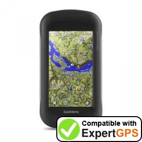
ExpertGPS supports all the Garmin Montana GPS receivers The Garmin Montana 600 is fully supported in ExpertGPS map software. Garmin Montana 600 The Garmin Montana 600t Camo is fully supported in ExpertGPS map software. Garmin Montana 600t Camo The Garmin Montana 610 is fully supported in ExpertGPS map software. Garmin Montana 610 The Garmin Montana 610t Camo is fully supported in ExpertGPS map software. Garmin Montana 610t Camo The Garmin Montana 650 is fully supported in ExpertGPS map software. Garmin Montana 650 The Garmin Montana 650t is fully supported in ExpertGPS map software. Garmin Montana 650t The Garmin Montana 680 is fully supported in ExpertGPS map software. Garmin Montana 680 The Garmin Montana 680t is fully supported in ExpertGPS map software. Garmin Montana 680t The Garmin Montana 700 is fully supported in ExpertGPS map software. Garmin Montana 700 The Garmin Montana 700i is fully supported in ExpertGPS map software. Garmin Montana 700i The Garmin Montana 750i is fully supported in ExpertGPS map software. Garmin Montana 750i The Garmin Monterra is fully supported in ExpertGPS map software. Garmin Monterra

Don't see your GPS above or on the master list of Garmin GPS receivers supported in ExpertGPS? Garmin comes out with new models faster than we can list them on the site. If you have a new GPS that isn't on this list yet, it's almost certainly guaranteed to work in ExpertGPS. Select the closest match in ExpertGPS, or send us an email and we'll add it to this list!

© 1998-2022 TopoGrafix – 24 Kirkland Dr, Stow, MA, USA
Try ExpertGPS: Advanced Geocaching and Mapping Software with Topo Maps and Aerial Photos